
Nanaimo-Info-blog: Canadian Anthem Canadian Flag Map of Canada
Canadian Anthem Canadian Flag Map of Canada
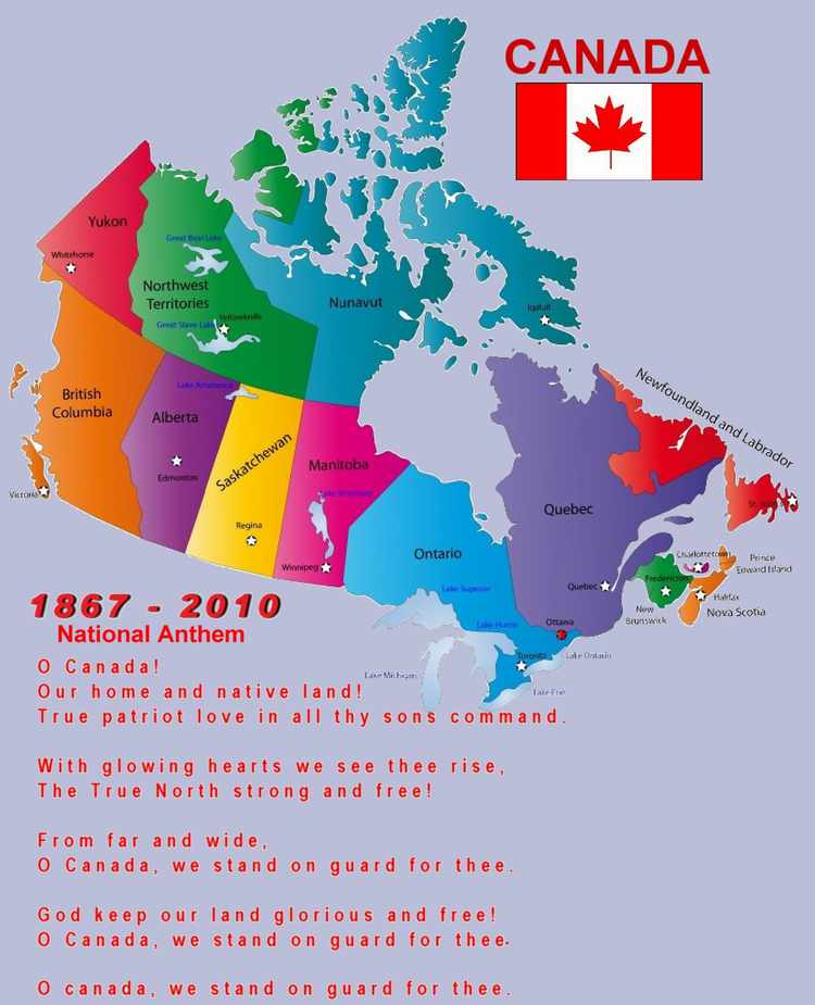
To Enlarge Click ImageIn the interest of patriotism I thought it would be good to be able to find a map of our country, our national anthem and our flag all in one place. I have also included the names of the Provinces and Territories as well as their capitols and populations.
If you consider the vastness of our great country and our small population it makes you wonder if we are really managing our natural wealth well and why we would have to be indebted to anyone.
Without peeking can you name all the provinces, territories and their capitals? Neither could I, so here they are, Province, Capital and Population (as of 2009 rounded):
- Alberta – Edmonton 3,687,700
- British Columbia – Victoria 4,455,200
- Manitoba – Winnipeg 1,222,000
- Newfoundland & Labrador – St. John’s 508,900
- New Brunswick – Fredericton 749,500
- Northwest Territories – Yellowknife 43,400
- Nova Scotia – Halifax 938,200
- Nunavut – Iqaluit 32,200
- Ontario – Toronto 13,069,200
- Prince Edward Island – Charlottetown 141,000
- Quebec – Quebec City 7,828,900
- Saskatchewan -Regina 1,030,100
- Yukon – Whitehorse 33,700
- Total Population Of Canada in 2009 – 33,739,900
Email ThisBlogThis!Share to TwitterShare to FacebookShare to Pinterest